

Tonlé Sap Lake is located in the northwest of the lower Mekong plain, formed by the collision and collapse of the Indian Plate and the Eurasian Plate. Southwest of the Tonlé Sap basin are the Cardamom Mountains, with heights of more than 1,700 metres (5,600 ft), and to the north are the Piandan Mountains with an average height of 500 metres (1,600 ft). The basin covers an area of 86,000 square kilometres (33,000 sq mi). The 120 kilometres (75 mi)-long Tonlé Sap River connects the Tonlé Sap Lake with the Mekong River and contributes 9% of the flow of the Mekong River.
 The size and water volume of the lake varies greatly throughout the year, with a minimum area of about 2,500–3,000 square kilometres (970–1,160 sq mi) and a volume of about 1 cubic kilometre (0.24 cu mi) in the dry season, and the water body expands in the rainy season, increasing the depth to 9–14 metres (30–46 ft). The maximum area is 16,000 square kilometres (6,200 sq mi), and the volume is about 80 cubic kilometres (19 cu mi).
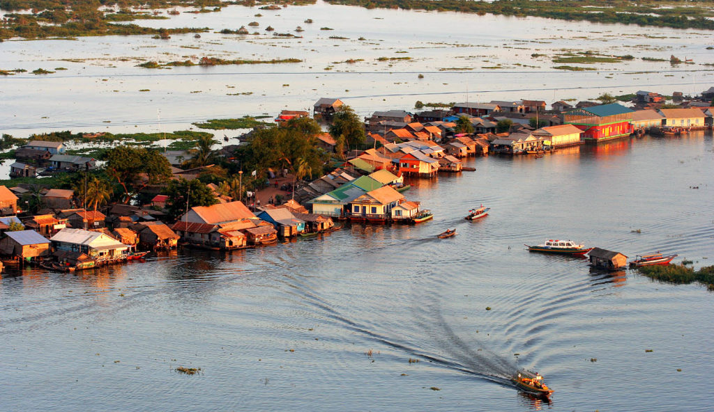
 The lake is surrounded by freshwater mangroves known as “flood forests”, accounting for 3% of the basin area, and the floodplain is surrounded by low hills and covered with evergreen or deciduous seasonal tropical.
The lake is home to at least 149 species of fish, 11 of which are globally endangered, and the lake area is also home to 6 near-threatened species, including spotted-billed pelicans, great bald storks, bengal bustards, black-bellied pelicans, and grey-headed fishing eagles and Far Eastern reed warbler, etc., and although much of the Lake District has been turned into farmland, 200 species of higher plants are still recorded.
According to Wikipedia
: The first and only Time Chamber-themed for males in Southeast Asia")


